Helicopter Crash in the USA: Aircraft Deviated from Route and Flew Above Authorized Altitude
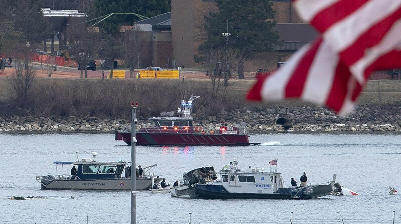
Initial analysis of the flight data for the Black Hawk helicopter, which crashed on Wednesday evening, indicates that it was flying 100 feet above the permitted altitude and veered off the prescribed route along the eastern shore of the Potomac River, reports NewsBox.
According to the data, two minutes before the collision, the helicopter was at an altitude of 200 feet above East Potomac Park, which matches the maximum allowable height on Route No. 1. As it crossed the Potomac River, the helicopter began to ascend, rising from 200 to 300 feet, bringing it closer to the airport and outside the established limit. It maintained this altitude until the last seconds before the crash, after which it rapidly descended to 200 feet, reports CNN.
Additionally, flight tracking data suggests that the Black Hawk diverged from its standard route along the river's eastern bank and headed towards the river's center. Such a maneuver could have brought the helicopter into close proximity with Reagan National Airport as an American Airlines regional jet was approaching the airport.
Jan Pechenik, a representative from FlightRadar24, a provider of flight tracking data, mentioned that the available data provides grounds to believe that the helicopter was in an incorrect position. He also noted that the flight data for the Black Hawk is not perfect, as the helicopter transmitted a Mode S signal, which provides basic information about altitude and identification, unlike the ADS-B signal from the American Airlines plane, which contains much more data.
A full analysis of the helicopter's black boxes is necessary for a comprehensive understanding of the circumstances leading up to the collision. However, even the available data suggests the helicopter was in the wrong place and at the wrong altitude.